Suilven
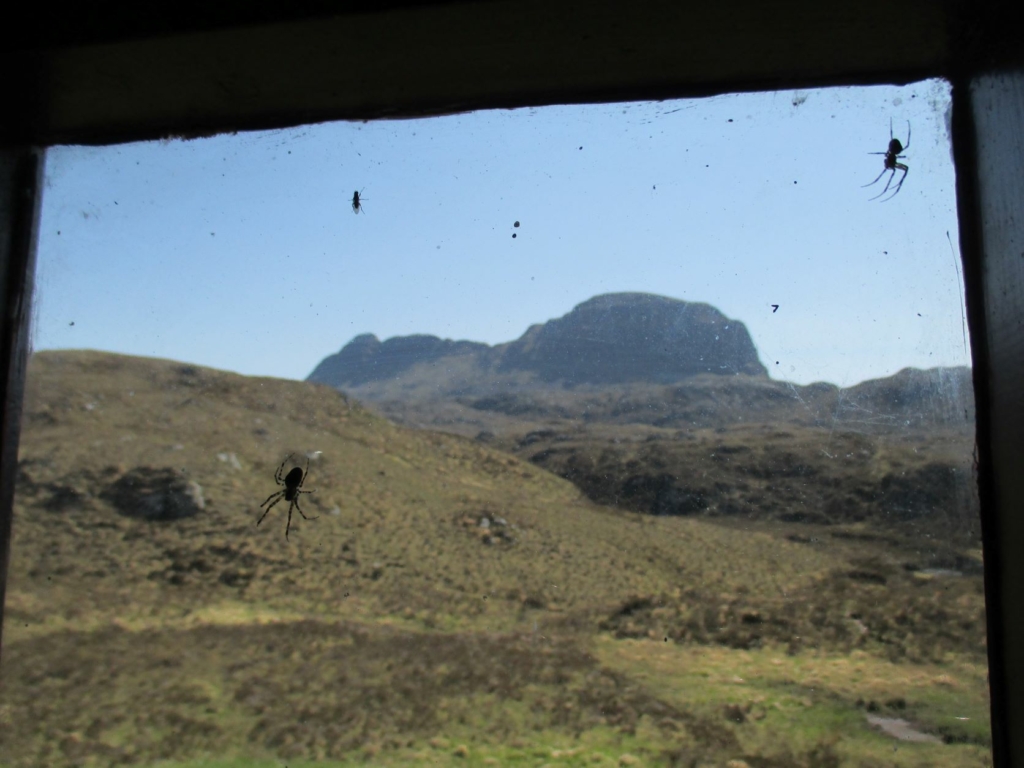
Suilven, from Suileag Bothy (photo by author)
Gemma Smith continues her journey through history and landscape, placenames and bothy culture, in a tribute to the wonder of Suilven.
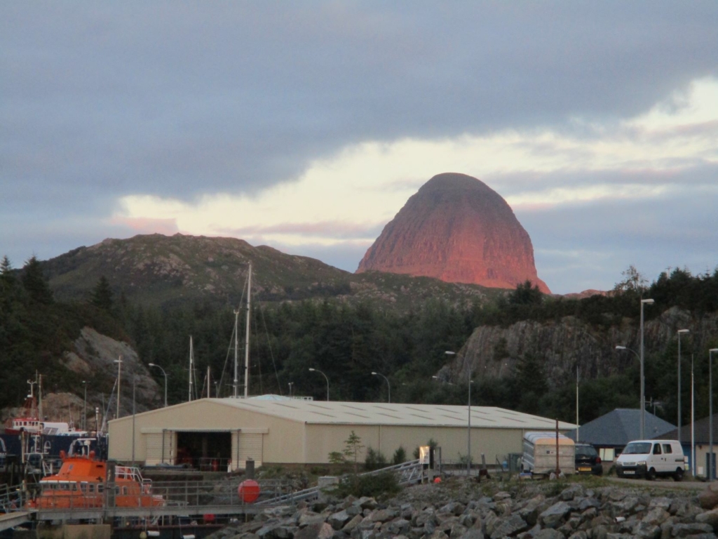
Suilven is the frustratingly prosaic name of a giant, oddly-shaped lump of red Torridonian sandstone in the middle of the parish of Assynt, North West Sutherland. Coming originally from the Old Norse súla fjell, ‘pillar mountain’ – later Gaelicised with beinn substituted for fjell – it has always struck me as a rather plain description of what is probably the most visually arresting hill in the whole of Scotland. Seeing as it resembles a hunched-over, sleeping beast from most angles I didn’t quite buy it myself until earlier this year, when on a gloriously bright and clear September day I stood on the beach at Tolsta in the north of Lewis and looked across The Minch to Suilven and its neighbour, Canisp. According to Icelandic toponymist Oddgeir Eysteinsson, this second name is probably from the Norse kambsnípa, ‘point of the comb/ridge’. The view here, of Canisp’s slanting ridge rising to a peak, next to what from this angle is the stark column of Suilven, made me realise that these hills may well have been named from the east coast of Lewis by Norse-speakers. The medieval Gaelic-speaking inhabitants of Assynt understood this name differently; having lost sight of the Norse meaning, they decided it was sùil-bheinn, or ‘eye mountain’, for reasons that have not been recorded. It may have had something to do with lookouts and hill-top beacons – Orkneyinga Saga describes how fires were lit on top of hills to pass on messages or for navigation.
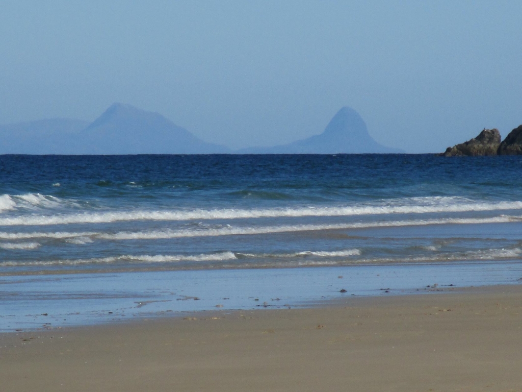
Canisp and Suilven from Tràigh Mhòr, North Tolsta, Lewis (photo by author)
As we saw at Sandwood, few Norse place-names survive in the far north-west of the Scottish mainland, and being mostly topographic – i.e. reflective of landscape features rather than settlement – suggest early and limited Norse settlement, unlike the Western Isles, Caithness and East Sutherland. Sutherland, Old Norse suðr land, ‘southern land’, only actually ever referred to the lands south of Caithness. It is likely that the north-west was never part of the lands ceded to the Norse by King Edgar in the eleventh century, and remained part of what would have been in Middle Irish, Airer Gáidel, ‘coastline of the Gaidheal’, from which we get the modern name of Argyll. Andrew Jennings of UHI has equated this with the term we find in the Norse sagas, Skotlandsfirðir, ‘Scotland’s fjords’. Toponymically-speaking, this area is particularly Gaelic.
The name Assynt itself is Norse, and is another one it took me a while to reconcile with the topography. The Celtic languages scholar W.J. Watson proposed the Old Norse áss endi, or ‘end of the rafters (metaphorically ‘ridge’)’, which I tried to make sense of as a name for the whole region, until I realised I was looking down the wrong end of the telescope. After
Roddy Maclean suggested that the name may have originally applied to the end of Quinag’s ridge, or the peak now known in Gaelic as Spidean Còinnich, ‘mossy pinnacle’, it occurred to me that Assynt was in fact an early Norse settlement located on the best patch of land in the parish, where we now find the ruins of Ardvreck castle and its former mains farm Achmore. This settlement in the shadow of Quinag’s southernmost peak, the áss endi itself, gave its name to the loch, and then also to the wider parish.
Despite spending most of every summer in the north-west, I have only been up Suilven once. I had such a freakishly perfect experience I am unlikely ever to attempt it again, although it was also the closest I’ve ever come to being airlifted off a hill by helicopter. In May the previous year I’d made it as far as the bothy in hailstorms and high winds, and contented myself with cheese, oatcakes and tea under shelter, and a read of the bothy book. I returned the next year at the same time to a different country, one in which the heat haze buzzed off the ground into a cloudless blue sky, and lizards rustled in the parched grass by the path. I hoped to camp up top, but it being my first summit camp wasn’t sure I’d make it – then I met a guy coming back down who’d been trying to do the same for thirty years and never got the weather. I had no excuses. This was prior to the path improvement work; in those days the section past the turn-off from the main track was so bad, for a while I thought I must have gone the wrong way. I have little memory of the climb up the gully, or of crossing either of the two narrow sections with 400m drops on either side. It was a miracle I got up there at all – as soon as I pitched my tent, I started shaking uncontrollably, with what I recognised as the onset of hypothermia. Despite the twenty-plus degree temperatures all day, I hadn’t eaten enough, and after spending almost an hour in the shade of the steep gully – Coire Dubh or ‘dark corrie’ in Gaelic – my body temperature had dropped to what may have felt comfortable, but was in fact dangerously low. For the few minutes it took me to warm myself up again I wondered whether this was going to be the time I had to call Mountain Rescue – I reckon you’re only allowed to do so once in your hillwalking career, so must choose wisely. Having got into my sleeping bag and forced down a Lochinver pie, the tremors stopped and I promptly passed out exhausted, missing what I was informed the next day was a spectacular sunset.
I first woke at about half past midnight. The first thing I noticed was how comfortable I was – it was so warm and still that I had to remove a layer of clothes. I opened my tent. The sky was still deep blue, with a handful of scattered stars and a bright, red line along the horizon where the sun had gone down. It never really got dark at all that night. I dozed until the sun came up between Quinag and Ben More Assynt, when I went out for my first wander of the morning. I could hear seagulls squawking on the coast five miles away. A massive bank of fluffy white cloud crept in from the east, pouring over the hills to form an inversion and leaving me happily stranded on a mountain island. I didn’t come down until lunchtime.
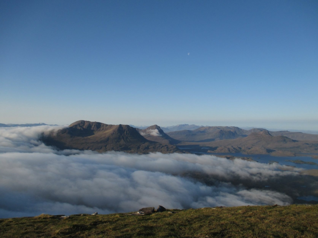
The view south over Coigach from the top of Suilven: Cùl Mòr, Cùl Beag, Ben Mor Coigach, Stac Pollaidh, Loch Sionascaig (photo by author)
I sometimes wonder if I had suffered from a bad case of summit fever that day. My one memory of the climb up the gully is at the halfway point, when I eyed a sandy camping spot at the lochside below longingly, but something kept driving me up. It’s not the highest or hardest of hills, Suilven, but it’s a long walk in – surprisingly so for anyone unused to Assynt’s underfoot conditions, where a mile can take you an hour to cover. Like Norman MacCaig though, I had become ‘possessed’ by this landscape. The first time I became aware of Assynt was when I saw the picture by one of Scotland’s most underrated mountain photographers, Streapadair, of his wee yellow bivvy bag atop Suilven in a perfect cloud inversion – I decided immediately that I had to do this myself. I may well have succeeded that day, but I was lucky it didn’t end in disaster. I’m still not sure what made me keep going.
I have since spent many happy times staying in the nearby bothy. Suileag, according to Edward Dwelly’s Gaelic dictionary means ‘little eye’ or ‘little orifice’, in this context describing the wee socket or hollow that the bothy now occupies. Bothy books are usually full of tributes to the ‘remoteness’ and ‘isolation’ of these places, but for me the appeal of Suileag is how well-connected it is. From here you can climb Suilven or Canisp, walk out to Loch Assynt or Elphin, and swim in a number of lochs. You can also leave Suileag in the morning, walk down to Lochinver for a shower at the leisure centre, pick up a couple of tinnies and something nice for your tea, and be back at the bothy just after lunchtime. When I meet walkers on the path and tell them I’m just popping down the road to the shops, they seem bemused, as though we’re supposed to forget there’s a village there as soon as we pass through the deer gates. The first time we walk anywhere it is an epic journey into the unknown. Familiarity compresses space and time. I skip along this path now like it’s nothing, having named significant stages on the way: there’s The Long Meandering Hill of the Big Slabby Stones, then there’s The Wee Bastard Hill of Scree, then there’s The Hill You Always Forget About, and then after an hour or so you’re home.
Suileag bothy nestles in its wee hollow (photo by author)
In my time spent in this bothy I have encountered a steady stream of men gripped by a slightly manic determination to scale Suilven, no matter what the conditions. It is for many a particularly compelling hill, my former self included. Summit fever is one thing, but these days the desire to get that killer shot for the ‘Gram sometimes seems almost as powerful a motivation. I passed one spell of wild weather in Suileag very comfortably, getting through a couple of books in front of a cosy fire, courtesy of the ghillies who took pity on me and brought me a cartload of wood. That week a succession of visitors came by regardless, all convinced that the clouds would clear for them at the last minute. Some were still set on camping up the top – one novice arrived with a £20 Tesco Value tent in a box. One boasted of expeditions in the Himalayas and dismissed Suilven as ‘not even a Munro’, but gave up and turned back half-way up the gully. I comforted them with the famous entry in one of the old bothy books, by the guy who made it as far as Suileag thirteen times before finally making it up the hill.
Suilven looming particularly suggestively behind Lochinver one late summer evening (photo by author)
Werner Herzog’s 1985 documentary about the great alpinist Reinhold Messner, The Dark Glow of the Mountains, is a short, sharp shock of a film like a dip in an icy mountain pool, and probably the best film about mountaineering ever made. Herzog accompanied Messner and his climbing partner Hans Kammerlander on their expedition to climb Gasherbrum (Hindi rgasha brum, ‘beautiful mountain’) in the Karakoram Range, asking ‘what is the fascination that drives them up to the peaks like addicts?’ The young Messner’s chat is wild, showing a piercing awareness of his own absurdity. ‘I think mountain-climbing is a sign of degeneration in mankind’, he tells Herzog, explaining that folk who live in the mountains have to work too hard to want to climb them. He says of his neighbours back home in South Tyrol that they ‘still tell me to this day that I’m crazy, that it just doesn’t make sense to climb mountains, that it would be much smarter to use my energy for something else – and they’re not entirely wrong.’
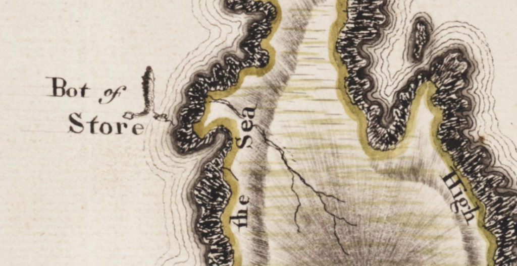
Great towering rocks seem to have an especially potent draw, whether it’s the Himalayas or the Highlands. On my first visit to Assynt I met two strapping ski instructors from Colorado at a hostel, who confidently announced to me, as well as the warden and another female guest, that they were there to swim out to and climb the Old Man of Stoer, a sixty-metre sea stack. ‘Are you, aye?’ we replied almost in unison, over the howling gale outside in the background. Sea stacks like the Old Man seems to invoke similarly obsessive tendencies in outdoorsmen as Suilven. ‘Old man’ is a 19th-century euphemism: in Gaelic it was known as the bod or ‘penis’ of Stoer, and the graphic depiction in John Home’s map of 1774 illustrates how fitting that name was. Bods abound in the Gaelic landscape – see also Bod a’ Mhadail, ‘penis of the dog-fierce’, a spiky little rock near the top of Cùl Mòr. The hostel warden phoned her pal on the coastguard to warn her of our American friends’ plans, but they returned that day bone-dry, having fallen out with each other completely.
In The Other Side of Sorrow: People and Nature in the Scottish Highlands, Jim Hunter has written of the contrasting attitudes towards the idea of ‘Nature’ that we find evidenced in Gaelic literature compared with anglophone romanticism. After Kathleen Jamie’s masterful deconstruction of Robert Macfarlane’s The Wild Places, there is little left to say about the Lone Enraptured Male seeking the sublime in the hills. In more recent times a more Americanised, macho ‘wilderness’ ideology seems also to have influenced our perceptions of and interactions with Highland landscapes. It is important to remember where the roots of this adventuring, ‘pioneering’ attitude lie. In her excellent book Native American Environmentalism, Joy Porter includes a powerful critique of the book and film Into The Wild, about Christopher McCandless, the young American man who died trying to live alone in an old bus in the Alaskan bush:
…the central subject of neither the book nor the film of Into the Wild is in fact wilderness. Instead their focus is on the awkward task of coming of age and the self-testing and risk-tasting impulses that impel young males as they work out how to heal emotional wounds from the past. Into the Wild is not about engagement with land, nature, or landscape even on a reciprocal aesthetic level. It is about the emotional needs of a certain type of young American male, one who pays only limited attention to the specifics of place or to the histories, stories, wisdom and communities of those who for generations have lived in that place. To the extent that Into the Wild makes land into landscape, a passive backdrop for an emotional and spatial journey with a white American male at the centre, it does both land, nature and environmental justice a disservice. It perpetuates a centuries-old American narrative where land and nature are there to serve white male needs, not least the need to forge an ‘authentic’ identity. Thus conveniently it is constructed as ’empty both of indigenous presence and of the intricate and messy realities of competing frontiers, post-colonial populations, and of meaningful ‘society’ however defined.
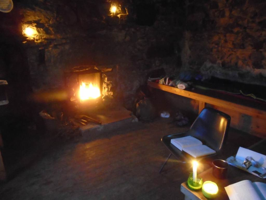
Cosy times in Suileag bothy (photo by author)
If you are ever lucky enough to encounter one of Scotland’s rarest species, the Old-School Bothy Guy, you will find they have a lot more in common with Tom Weir than Bear Grylls. I have only had the privilege a handful of times – two in particular stick in my mind. I spent my first night in Suileag on a random Tuesday when my plans for another high camp up Cùl Mòr were rained off. I made it just before the weather broke, to find Harry chopping up some onion, carrot and potato to make lentil soup on his wee stove. His initial standoffishness softened after he’d ascertained I wasn’t an idiot, and we sat talking until there were only embers left in the fire. Harry was a cartographer who got bored with desk work and retrained in dry-stone walling. He has such a low-key manner that he can casually throw sentences into a conversation such as, ‘that time I spent three nights camping out on the Cuillin Ridge’, or, ‘that time I tramped across Assynt and Coigach for two weeks without a tent, sleeping in caves’ without sounding like he’s bragging. We chatted as much about Scottish history and politics as the outdoors – this was only a couple of years after the referendum. Over the years he has filled me in on the locations of the Highlands’ ‘secret’ bothies via email.
The following year I returned for what was only supposed to be two nights, and met Dave. Striding down the track resplendent in hiking boots, aviator shades, and tiny red shorts, he could only have been a retired mountain guide. Dave was born in Arbroath and had spent most of his life working in North Tyrol. A consummate outdoorsman, he was calm, collected and utterly self-contained, making only the gentlest of impacts on his environment. Declaring it too hot for climbing hills, he spent most of his time at the nearby lochans looking for black-throated divers. He was such lovely company I ended up staying twice as long as intended. It was the end of May again, about twenty-odd degrees and sunny every day, but with a strangely fierce wind blowing in from the east. Every evening we took our chairs out to the west side of the bothy and sat there with our books, sheltering from the wind and watching the path to see if anyone would join us that night.
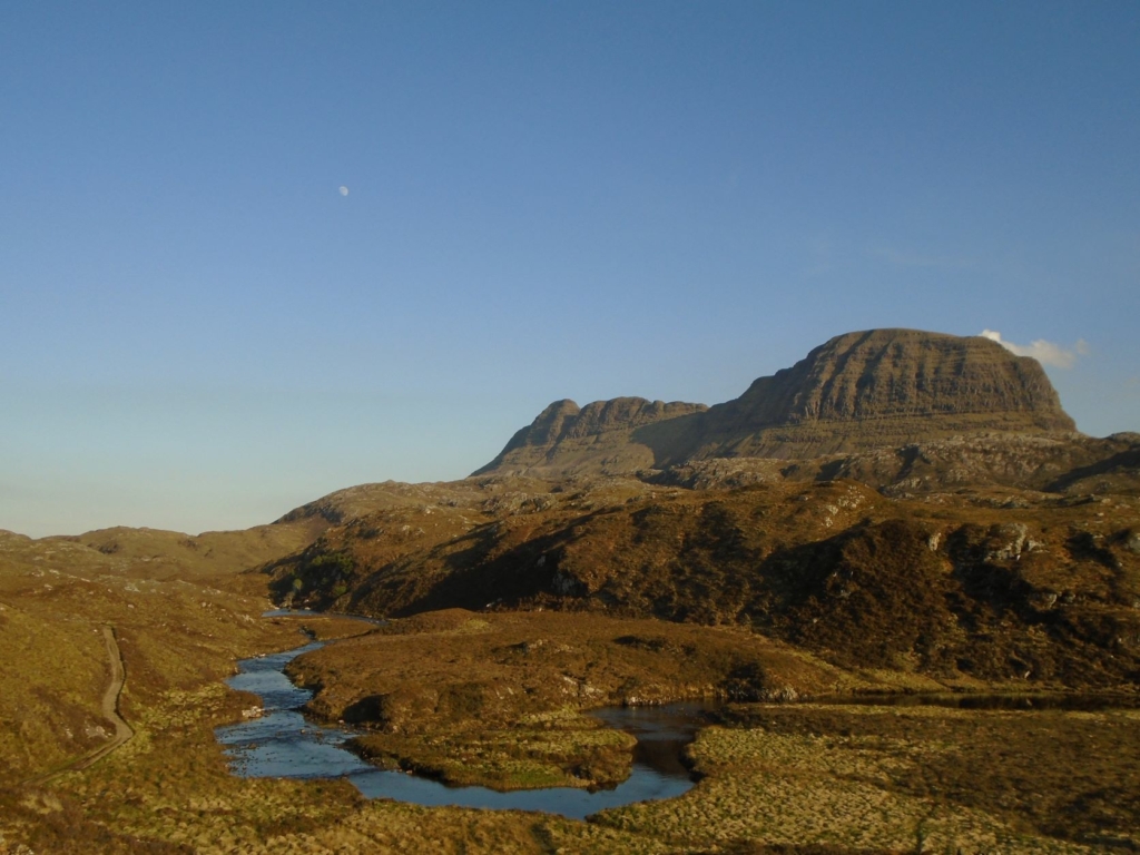
Suilven and Abhainn na Clach Àirigh, from the bothy path (photo by author)
I can however count the number of other solo female bothy-goers I have met in my life on one hand. Things are changing – the pandemic lockdowns introduced many newcomers to the hills, something that should only be encouraged – but the Scottish outdoors is still conspicuously dominated by white, middle-class men, some of whom can look positively put out on arriving at the bothy to find a small, middle-aged woman in residence, cooking some pasta for her dinner. The irony of this is that our mountains and moorlands were historically, in the summer months, mostly traversed and inhabited by women and children going back and forth to the shielings, producing food for their communities. Prior to the introduction of ‘Improvement’ ideology and commercial sheep-farming to this area, Suileag was itself the site of a shieling – as is evidenced on John Home’s 1774 map of the farm of Drumsurdland. In some bothies you will find histories of the building itself, most of which were 19th-century shepherd’s cottages. Few delve any deeper into the past of the locations of these ‘remote shelters’, but looking at pre-Clearance maps such as Home’s, or William Roy’s Military Survey of 1747, we will find many were built on the sites of old shielings or townships and have a long history of habitation.
The wee grassy spot at Suileag contains layers of archaeology, with the outline of shieling huts visible down closer to the river, Abhainn na Clach Àirigh, and the associated old turf wall. There are later rectilinear structures near the bothy itself, where someone has clearly built a home or shelter sometime in the late 19th or early 20th century. I suspect though that Suileag’s history stretches much further into the past than its incarnation as a shieling. The first thing you see as you arrive is the impressive drystone wall that surrounds the hollow. Those stones had to come from somewhere, and as anyone who has ever dug large stones out of the ground will tell you, it probably wasn’t from there. Could that prominent green mound at Suileag conceal the remains of a prehistoric structure whose stones have been repurposed? The place-names certainly suggest so. The nearby loch, now on the OS as Loch an Alltain Duibh, ‘loch of the wee dark burn’, is on William Roy’s 1747 map instead referred to as L.[loch] an turisoulach. The first part of the specific element here is surely tùr, Gaelic for ‘tower’, giving us a meaning of ‘tower of Suileag’ or perhaps ‘watch-tower’.
The green mound at Suileag picked out in the evening light (photo by author)
The path here, which cuts across the parish from Lochinver in the west to Elphin in the east, used to be the main road – as the Reverend Mackenzie tells us in the 1795 Old Statistical Account, this was known as the ‘Ed-ra-vine road’, from eadar dà bheinn, meaning ‘between two mountains’. The river it runs alongside is named after Clach Àirigh, ‘stone shieling’, a beautiful wee hollow just past the Suilven turn-off. Although the name indicates this site was once a shieling, by the time of the OSA the Reverend tells us Clach Àirigh was a permanent habitation, ‘a remote corner of Ledbeg farm’. The track north of the bothy passes two further micro-settlements, Achadh Mòr and Achadh an Ruighe Chòinnich, which would have been en route to the old townships around the west end of Loch Assynt. These may also have been shielings, but the generic element achadh, ‘field’, implies cultivation. The path here is now badly overgrown with heather and bracken, but now and again you will come across something like an obviously constructed ford, and have occasion to think about the person who built it hundreds of years ago, so that they and everyone who came after them could cross the burn more easily.
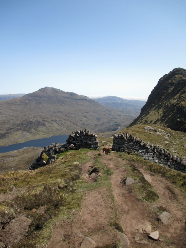
There is a beautifully put-together dry-stone wall across the top of Suilven itself. Stories about the origin of the wall circulated for years among hillwalkers: it was a land boundary, a poor project, a dyker showing off, a Labour of Hercules style-feat performed by a young man to win the hand of a woman in marriage. The local oral tradition had always insisted that it was a sheep-wall, designed to keep them away from the most precarious drops around Caisteal Liath. Documentary evidence supports this story – accounts show that it was built in the late 1840s for the tenant John Scobie of Glencanisp sheep farm and cost him the grand sum of £50. According to legend, John Macleod, one of the dykers, lived twelve miles away at Ardroe, and had to walk home and back every day to milk his cow. The wall was built because the new commercial Lowland sheep breeds were not as canny as the wilier wee native sheep and goats that preceded them and kept wandering off the top of the hill.
It is telling that few of the locals are particularly enamoured of Suilven, and will usually tell you their favourite hill is Quinag – Allan Macrae, the figurehead of the Assynt crofter’s buyout in 1992, called her ‘proud Quinag, fairest of them all.’ As we saw last time, Quinag is from the Gaelic a’ chuinneag, ‘the milk pail’, a name I think is most likely metaphorical, referencing the produce that came down from its shielings in the summer. The great corrie between two of Quinag’s wings – Sàil Ghorm ‘blue/green heel, and Sàil Gharbh, ‘rough heel’ – is called in Gaelic Bàthaich Cuinneige, ‘byre of Quinag’, indicating the mountain’s significance in past times. The uplands of Assynt were a shared resource, with each baile or township having rights to shieling grazings. We didn’t use to go to the hills to escape life, but to sustain it.
Both Suilven and Quinag and the areas around them have been classed as ‘wild land’ by NatureScot. Their now well-critiqued 2014 ‘wild land’ maps literally erase the placenames of the area, replacing them with blank space. Can land really be called ‘wild’ if that status depends on an act of cultural vandalism? NatureScot have since acknowledged the ecological importance of Gaelic, but the maps are still brandished by conservationists and rewilders as if they are in any way scientific. I agree with Kathleen Jamie when she says that ‘wild is a word like ‘soul’. Such a thing may not exist, but we want it, and we know what we mean when we talk about it’. We are only so compelled towards ‘wildness’ now because our lifestyles have become so dysfunctional. Escaping treats the symptoms rather than the cause.
Romanticism, ‘Improvement’ and wilderness ideology are all forms of othering the landscape that provide a convenient justification for emptying it of people. It was a description of Assynt in such fantastical terms that was said to have prompted the crofters’ buyout in 1992. The estate agent’s particulars claimed that:
One need only enter Assynt and see the great sphinx-like mass of Suilven to sense the atmosphere of unreality, almost fantasy, which pervades the character of the people who live there. Mountains such as Quinag, Canisp, Ben More Assynt, Cul Mor, Cul Beag, Stac Polly and Conival have immense power to impress and serve to emphasise that man himself is perhaps the alien in this landscape.
This is obviously grossly offensive to the local inhabitants. As John MacAskill countered in his 1999 book that tells the story of the Assynt buyouts, We Have Won the Land:
This is a description of the land which can be recognised and understood by people who see the Highlands as part of the dwindling resource of wild and desolate scenery in the British Isles, as a place where isolation and the absence of humans is to be treasured. But, of course, it is a description which by its emphasis on the unspoilt wilderness can be said to ignore, or at least put to one side, the fact that people work on the land in this wilderness and that before the clearances and emigrations of the late eighteenth and nineteenth centuries, many more people had occupied the land.
Suilven is no magic mountain. It really is just a hill. It doesn’t need a meaningful name, and you don’t need to get to the top. And next time you leave the bothy, observe a dying tradition, and sweep the floor and set the fire for those who come after you. This isn’t the wild – this was, and still is, somebody’s home.
Approached from a boat Suilven appears to have two eye sockets!
Good article
Brilliant! An excellent read.
Thought provoking and with some brilliant links too. Thank you. Lang may yur bothy lum reek.
What a lovely read. Thank you. You’re not the first, and won’t be the last person to be saved by a Lochinver pie!
Great article Gemma. Resonates a lot with me.
We’ve done a lot of sea-kayaking on the West coast of Scotland and it can be very spooky to attempt to land in an unfamiliar bay on a now unihabitated island. We look at the sea, the sheltered areas and try and figure out the safest spot to land our kayaks without drowning. Many many times our chosen spot has a strip of cleared boulders leading to the shore. Often not used for decades. So we are simply following the sea-awareness and paddle strokes of some very ancient inhabitants…
Thank you so much. I really enjoyed this and agree so much with your conclusion.
Great read thank you.
I would love to read Kathleen Jamie’s deconstruction of wild places and her quotes are very interesting. Where would I find the deconstruction ?