Sandwood
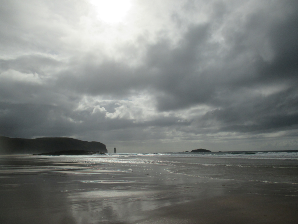
Sandwood Bay, May 2015 (photo by Gemma Smith)
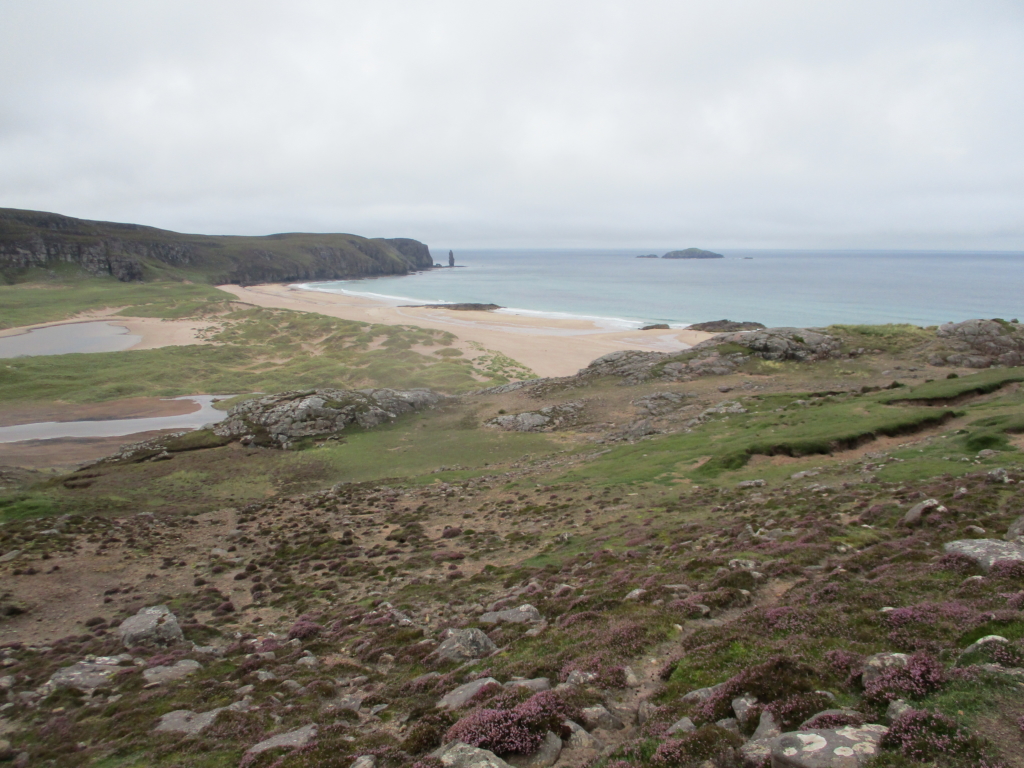
Sandwood is one of a cluster of rather curiously mangled place-names in the far north-west of Scotland, along with nearby Oldshoremore and Oldshore Beg. Oldshore has come into Gaelic as Aisir, meaning ‘pass’, with the additional mòr and beag specifying ‘great’ and ‘small’, but from the array of early forms collected by Ainmean-Àite na h-Alba, the original meaning is anybody’s guess. Cape Wrath could also be included in this group – Am Parbh in Gaelic. The original Old Norse word hvarf means ‘turning point’ – nothing to do with Biblical sin. Sandwood is best known now for the famously spectacular bay, the last beach before you reach that turning point at the most northerly extent of the west coast, and an essential Instagram opportunity for the box-tickers of the NC500. Although the four-mile walk keeps numbers to a relatively manageable level, it is not unusual these days to find a dozen or so tents camped out among the dunes on a fine sunny night, as there was on my second visit in late August last year.
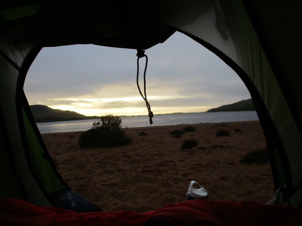
The first time I camped at Sandwood Bay several years ago, however, I had the place to myself and woke just after four in the morning to one of the most astonishing sunrises I’ve ever seen. The tide was far out to sea, and the sky’s brilliant colours were mirrored on the thin layer of water left on the sand, leaving me feeling minute and dazzled in a vast, swirling blaze of mauve, pink and gold. After a somewhat taxing three-week walk from Achiltibuie during some of the worst spring weather in years, it was the end my trip sorely needed.
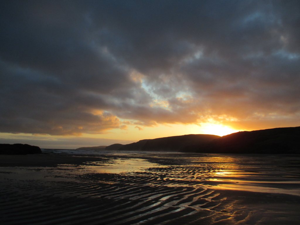
Sunrise at Sandwood Bay, May 2015 (photo by Gemma Smith)
Sandwood is usually translated as the Old Norse sandvatn, ‘sand water’ – indeed the John Muir Trust information board at the car park proudly declares ‘Vikings were here!’, illustrated with a photo of a wee girl wearing the horned helmet famously unattested by any actual archaeological evidence. This theory is supported by the existence of other Sandvatns: for example the lake in Iceland about sixty miles east of Reykjavik, which due to its sandy bottom has a similar appearance to the often aquamarine-hued Sandwood Loch that lies just behind the salmon-pink dunes of the beach. In contrast with surrounding areas such as Caithness and the Western Isles, there are very few Norse place-names in North West Sutherland, and the ones that exist – including potentially, Sandvatn – are of an older, topographic stratum, indicating that Norse settlement here was very early and probably short-lived. I imagine the logistical implications of portaging a longboat anywhere in the parishes of Assynt, Eddrachillis or Durness combined with the scarcity of arable land meant it probably wasn’t worth their bother.
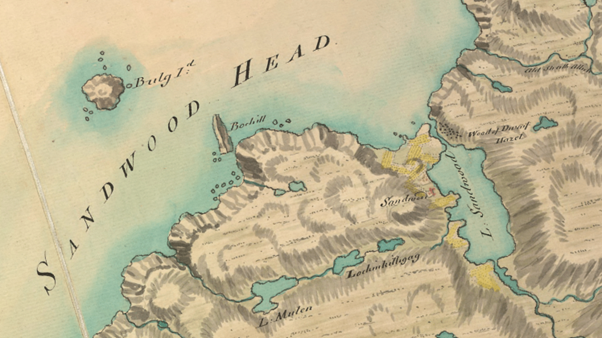
William Roy’s Military Survey of Scotland, 1747
As William Roy’s Military Survey map of 1747 shows, Sandwood was the name of the baile or township that once sat on the south side of the bay. More observant visitors will have noticed the ruin of the subsequent 19th-century shepherd’s cottage sat on the expanse of grassy land on their right as they approach the beach, along with the remains of the original head dyke and cultivation marks from when the land was still worked. It makes a first appearance on Timothy Pont’s late-16th century map as Sandwatt, the ‘w’ here being pronounced as a ‘v’. This evidence supports the sandvatn interpretation, and it also corresponds phonetically with how it came to be understood by Gaelic speakers: Seannabhad, meaning ‘old place’.
Seann is one of the most enigmatic elements in Gaelic place-names. Fellow bothy-goers will recognise it in Shenavall, seanna bhaile, ‘old town(ship)’. Although with some examples the meaning is clear – Seann Talamh near Invergarry, ‘old land or soil’, can be interpreted as ‘the land that we used to cultivate’ – others are more obscure. Just south of Sandwood there lies in the bay of Sheigra a rock known as Seana-Sgeir, ‘old skerry’ – a puzzling name when rocks are old by definition. The secondary place-names around Sandwood as recorded by the OS six inch first edition in 1878 evidence the Seannabhad interpretation of Sandwood, the map depicting Tràigh an t-Seannabhaid ‘(sandy) beach of Seannabhad’ and a corresponding uidh (‘ford or channel between two bodies of water’). To local Gaelic speakers, Sandwood was ‘the old place’, in the sense of ‘the place where we used to live’ – whether it initially came from Old Norse or not.
Ruins and old cultivation marks at the Seannabhad, August 2020 (photo by Gemma Smith)
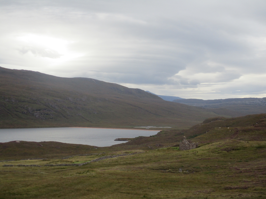
The purpose of my third visit to Sandwood in July was to investigate shieling sites further down the strath – I spent much of this summer following sheep trails and deer trails to places that humans now rarely go. The strath in question is called on modern maps Strath Shinary, from srath seann àirigh, ‘strath of Seann Àirigh’, Seann Àirigh itself being ‘old shieling’ – this is marked on the modern OS map as Sinairidh, a ‘sheepfold’ roughly halfway between the south end of Sandwood Loch and Strathan bothy. An old shieling is exactly what one would expect to find within a few miles of an old place, given that according to the cartographer Blaeu in his 1654 atlas, in Sutherland ‘the farmers from the nature of the region are more dedicated to pasture than to field.’ In his 1901 book Kinlochbervie: Being the Story and Traditions of a Remote Highland Parish and Its People, Alexander Macrae attests that Strath Shinary once provided ‘good pasture for the whole district’, and archaeological investigations in 1998 found evidence of groups of shieling huts scattered right along the strath.
I spent five days exploring the area, from east of the bothy at Strathan (‘wee strath’) right down to the bay, unfortunately at the absolute height of cleg season. At Strathan itself ruined structures from an old settlement there can be found around the bothy among the overgrown bracken, heather and rushes, as can old feannagan or ‘lazy-beds’ and fragments of the rough pony tracks that would at one point have linked the scattered townships and shielings of the Cape. There is little in the way of paths past here now, and the going is heavy. On day two the wind picked up and grew steadily stronger over the remainder of my trip. The following night I pitched my tent on the sandy beach at the south end of the Sandwood Loch, – you would be hard-pressed to find a spot flat enough anywhere else nearby. I went to retrieve my rucksack from where I’d dropped it earlier, relieved to be out of clegs’ reach. I turned back around to see my tent tumbling in slow motion into the loch like a giant beach ball. It took until halfway through the next day before my boots dried out.
Clumps of heather sprout from the sand at Sandwood Loch, July 2021 (photo by Gemma Smith)
I camped the last, sleepless night in the dunes at Sandwood Bay itself, my tent swaying side-to-side like a rowing boat in a stormy sea, despite being weighed down with several large rocks. The next morning under an ominously low cloud I began the trudge across the bay’s soft, deep sands, face-first into the relentless, driving gale. Halfway along I met another camper, on his way to fetch water from the river. ‘It’s been like this for three days’, he told me, wild-eyed and weather-beaten. “What the hell are you doing staying here for three days then, you mad bastard?” I thought and carried on my way. I have never been so glad to see the John Muir Trust’s fancy pathwork, or the inside of the bus shelter at Kinlochbervie several miles later. I got out my stove and enjoyed my first hot drink in days, and decided that Sandwood must have been the ‘old place’ because they were all driven mad by the wind and the constant roar of the sea, and retreated to somewhere more sheltered down the strath. I considered the possibility that perhaps there are some places that are just less accomodating than others, and there is a good reason why they are no longer inhabited.
[Read: Altnaharra by Gemma Smith]
By the time of my fourth trip to Sandwood, a few weeks later in August of this year, the bothies had re-opened, so I walked on to stay at Strathchailleach. Strathchailleach bothy is where the hermit known as Sandy (James McRory Smith) famously lived for over 30 years until 1994, making a 26-mile round trip on foot to collect his pension and his shopping every fortnight. Nine miles from Kinlochbervie was enough for me, especially with unexpected thigh-deep wade across the outflow of a swollen Sandwood River. After that it’s an hour of pure bog, – it’s no wonder so many entries in the bothy book express relief at having made it.
It is likely that Sandy – who sported a long, white beard and heavy, old-fashioned clothes – was the source of the reports by campers of a ghostly mariner seen wandering the beach at Sandwood Bay. By that time few would have believed a real person lived anywhere on the Cape – it is thought that Strathchailleach was probably the last house in mainland Scotland to have been inhabited without any services whatsoever – no road, plumbing, power or post. I certainly felt his benign presence in the days I spent there, seeing just one other human the whole time: a gallus Romanian woman completing the Cape Wrath Trail with her wee dog, both of whom looked like they’d rather stay in front of the peat fire with me by that stage. I re-read the bothy copy of Highland Hermit, Sandy’s biography by James Carron, and felt enormous sadness at his story – both that his experience of life necessitated such a dramatic retreat from the world, and also that he eventually had to leave this place, spending his last years in a caravan in Kinlochbervie.
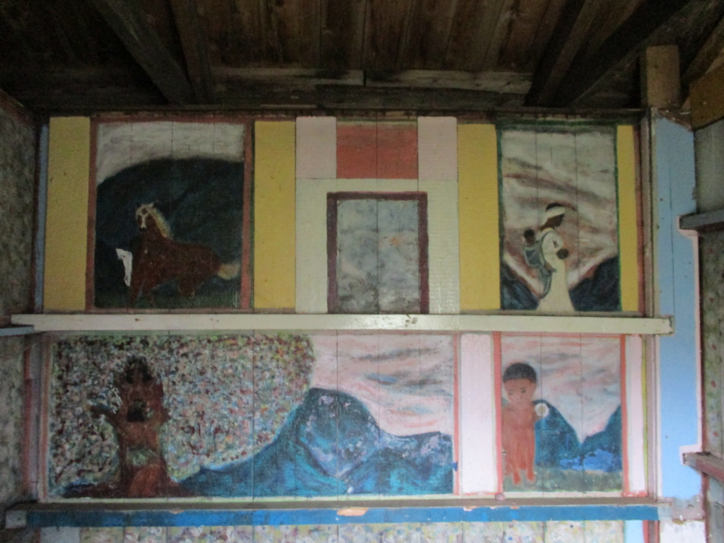
Sandy’s artwork still adorns the walls of the bothy, August 2021 (photo by Gemma Smith)
For all its ‘remoteness’, Strathchailleach would have been a relatively commodious habitation, occupying an expansive green hollow among the low hills of the Cape and backed by a fine river, Abhainn Srath Chailleach. You would certainly never want for water or peat, there is a decent patch of cultivable land, and in previous centuries venison and fish would have been abundant. James Carron managed to track down a local man called Norman Morrison, whose mother was born here in the shepherd’s cottage in 1897, before moving with her family to the house at Sandwood. He said she spoke of both places with great affection and described how they used to feed their chickens with salmon.
The name Strathchailleach is from srath na caillich, ‘strath of the cailleach’, and a photo a visitor has left in the bothy information folder suggests this may reference a rock formation that resembles a female form in profile, where the river tumbles down a channel in the cliffs to meet the sea. Cailleach is not straightforwardly translated; it can mean simply ‘old woman’, but in place-names, it is more likely to refer to the Gaelic mythological figure of The Cailleach, and is particularly common in conjunction with rocks or water features. As Alasdair Whyte points out in his recent essay on cailleach names, the element is sometimes conflated with coilleach, ‘cockerel’, with metaphorical meanings including ‘rapids’ when related to water, but the topography here makes a cailleach interpretation more likely. Just inland lies in the 2007 OS Explorer Càrn Naomhag, more correctly in the 1878 OS six-inch first edition Càrn Naomha – ‘holy hill’, according to the OS Name Books’ translation, the explanation for this probably lost forever. A quarter-mile south down the coast a hollow called Làrach Tigh Dhonnachaidh, ‘the ruins of Donnachadh’s house’ conceals the remains of a dwelling and a wee patch of feannagan. Another quarter mile south is the site of prehistoric homestead in which part of a rotary quern was found, nestled on a small flat on the hillside at the north side of Sandwood Loch, next to where Roy’s 1747 map depicts a ‘wood of dwarf hazel’. The third-to-last lochan walkers pass on the JMT path to the bay is called Loch a’ Mhuillin, ‘loch of the mill’. It certainly wouldn’t suit everyone, but there have always been people who wanted to live here. Our experience of these places is of our own making – I was a lot happier with four stone walls, a roof and a peat fire to go back to than I was when I decided camping the whole way was a sensible idea. The fact that I found Sandwood oppressively wild on my third visit was nobody’s fault but my own, and I expect its ghosts were laughing at me.
Returning to Sandwood Bay from the north, August 2021 (photo by Gemma Smith)
After the potato famine of 1846, Sandwood – like so many other townships in the area – was cleared of its inhabitants wholesale, and turned into a 1940-acre sheep farm, let to the Kinlochbervie merchant Hugh Mackay. These days what is now known as the Sandwood Estate is owned and managed by the John Muir Trust. From the north side of Sandwood Loch to the Keisgaig River is the Keoldale Estate, a result of the ‘Land fit for Heroes’ legislation after the First World War, and now the property of the Scottish Government. Many of the entries in the Strathchailleach bothy book are from crofters who have made the long walk in from the Durness ferry to graze their animals there. Recent attempts at a community buyout by Keoldale Sheep Stock Club were thwarted by the Executive’s refusal to allow the crofters to pay by instalment, but they are pressing on with development plans near Durness. North of Keisgaig is MOD land: the firing range was established in 1933, the MOD buying the land outright in 1999. This part of the Cape is now used as a stage for multi-service military training exercises, permitted for up to 120 days of the year, with public access restricted for that time. An Garbh-eilean (‘the rough island’) just along the north coast is used for target practice by the RAF and is regularly pounded with bombs in NATO operations.
It is a favourite thought experiment of mine to sit on the bench outside a bothy, or among the ruins of a de-peopled settlement, and imagine what these places may have become had history unfolded differently. What would they look like now if there had been no Clearances, if the indigenous people of these places had been allowed to continue to manage the land in their own way instead of being replaced with sheep? Strathchailleach would always have been an end-of-the-line kind of dwelling, but undoubtedly Sandy would have been able to get a lift home with his messages. Lovely, south-facing Strathan would surely be a decent-sized village, famous for its speciality Highland cheeses. At Sandwood I picture houses clustered around the loch, cattle on the common grazings, a wee pub serving local seafood, a couple of boats pootling about on the water. Would these ‘wild’ places really be the worse for it?
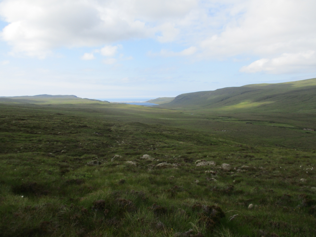
Strath Shinary, from the path to Strathan, July 2021 (photo by Gemma Smith)
Through studying place-names, I can no longer open a map and see anything like empty space or ‘wilderness’. Especially with the places I have spent time getting to know on their own terms – walking across them for days, sleeping in them, drawing water from their burns, overcoming the unfamiliarity that leads us to characterise them as harsh or inhospitable – I see something more akin to a storybook, the place-names tracing the paths that historical inhabitants made across the land, depositing their stories and their culture in the landscape along the way. What stories do these places hear now? We can still trace those old paths in the land if we follow the sheep trails and deer trails – the animals will lead us to the abandoned settlements and grazings that only they still frequent. They seem to carry still a memory of where to go; a memory of the places where we used to live.

Help to support independent Scottish journalism by subscribing or donating today.
I found this sad. There are many deserted settlements througout Scotland and this area is much more remote than most. As a boy we went to Lawers on Loch Tay and stayed it what was at one time a lint mill that was still inhabitable. We visited the tumbledown houses on the side of Loch Tay that had once housed a small community and was famous for the “Lady of Lawers”. We didn’t stay long as as my young sister found it eerie and haunted; something that stories and dark nights brings to more sensitive young children.
I would like to see facilities put in place so that the deserted places could again be inhabited. It would be a while before we got to Sandwood but with electricity and broadband there is no reason that our less remote silent places could not become alive again. The island of Eigg is an inspiration that could and should be replicated.
Many thanks for this Gemma. Your words and photos have captured the memory of this auld stravaiger of some of Scotland’s ‘wild places’, though I never managed as far as Sandwood. Your writing is just lovely!
We missed a trick when the urban slums were cleared into peripheral schemes and new towns. Many of our rural wastes could have been repopulated with garden cities: self-contained communities surrounded by ‘greenbelts’ containing proportionate areas of residences, industry, and agriculture.
Enjoyed the article!
As to the difficult place-names , Alexander Macrae in his 1901 book that you reference had different explanations for Strathcailleach, which he calls Strath Choilleach, i.e. wooded strath. And for Oldshoremore, which he thinks is Allt Siar Mor, basing this on the reference to `Alschermore’ in the will of the first Lord Reay (d 1649). Roy gives Old shores mor, almost the modern name, while the earliest OS map (1870s) gives Oldshoremore as the settlement, but uses `Fas Thire’ for the burn and hill-loch. Macrae mentioned `Fas Thire’ as a rival for `Oldshore’.
Hi Denis,
Re: Strathchailleach – I’d refer you my colleague Alasdair Whyte’s recent article on cailleach place-names in The Journal of Scottish Name Studies, Vol. 14 (2020). I have just noticed my typo – the conflation is usually with coileach, ‘cockerel’- single ‘l’. Given the surroundings, it’s not impossible that there were stands of hazel and the like -such as the one Roy depicts – around here when the Gaelic names were coined, and in that case it would certainly have been a landmark worthy of a name. In this case the early versions support cailleach, as does the rock formation where the river discharges into the sea.
I have read the Macrae book and I would say that both these explanations – allt siar and fàs-thire – are later Gaelic rationalisations of a potentially ON original name, much like Sandwood itself. Onomastic scholars of 100+ years ago did not have access to the same range of sources as we have now, so you have to be careful taking anything they say as gospel – there are also trends in interpretation as there is in any academic discipline. This is the current AAA record, which remains inconclusive (look under ‘research notes’): https://www.ainmean-aite.scot/placename/oldshoremore/
Slàinte a-rithist.
Not only is this a very insightful article. It is also beautifully written, thereby bearing fitting testimony to its subject matter.
Lovely article. More of this please.
Thanks. Gemma is a gift
I have enjoyed Gemma’s writing more than anyone’s. Would she consider researching Strathkanaird where, rumour has it, opposite our croft house, shipwrecked Spanish sailors from the Armada once sheltered and then stayed.
07774 843844
The name surely means valley if the can shaped fort, or Dun Canna at the head of the loch.